| Sea/Ocean |
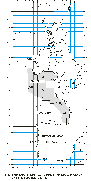
Bay of Biscay Celtic Sea |
| Ports |
Port of departure : Saint-Nazaire (France)
Port of return : Brest (France)
|
| Project |
INFORMATION SYSTEMS, ECONOMY, DIAGNOSIS OF RESOURCES |
| Scientific Authority |
IFREMER STATION DE LA ROCHELLE-L'HOUMEAU Place du Séminaire BP 7 17137 L'HOUMEAU +33 (0)5 46.50.94.40 |
| Participating bodie(s) |
IFREMER/DRV/RH/ Boulogne sur mer, Brest, Lorient, Nantes, L'Houmeau, IFREMER/DRV/RH/ECOHAL/Nantes, IFREMER/DRV/VP/GA/Nantes, IFREMER/DRV/ARN/Brest, IFREMER/DNIS/NO/Brest, IFREMER/TMSI/RED/EM/Brest, TMSI/RED/HO/Brest, IFREMER/DRV/RA/LERPC/La Tremblade, DCN/DACN-STL/ La Tremblade, CREMA/L'Houmeau, Institut Royal de Sciences Naturelles de Belgique.
|
| Discipline(s) |
- CHEMICAL OCEANOGRAPHY
- FISHERIES
- BIOLOGICAL OCEANOGRAPHY
- PHYSICAL OCEANOGRAPHY
| Code |
Label |
Quantity |
PI |
| B19 |
Demersal fish Sorting, weighing, measuring by species and station |
133 specimens |
LEAUTE Jean-Pierre |
| B20 |
Molluscs Sorting, weighing, measuring by species and station |
133 specimens |
LEAUTE Jean-Pierre |
| B21 |
Crustaceans Sorting, weighing, measuring by species and station |
133 specimens |
LEAUTE Jean-Pierre |
| B90 |
Other biological/fisheries meas. Age determination, maturity ogives for various species |
4000 specimens |
LEAUTE Jean-Pierre |
| D71 |
Current profiler (eg ADCP) ADCP by night |
- |
LEAUTE Jean-Pierre |
| G73 |
Single-beam echosounding Continuous, on station and in transit |
- |
LEAUTE Jean-Pierre |
| H10 |
CTD stations Vertical profiles |
140 stations |
LEAUTE Jean-Pierre |
| H71 |
Surface measurements underway (T,S) Thermosalinograph |
- |
LEAUTE Jean-Pierre |
| M06 |
Routine standard measurements Wind and weather stations |
- |
LEAUTE Jean-Pierre |
|
| Summary of measurements |
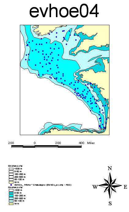
- -143 standardized bottom trawlings (133 validated), during day time of a 30 minutes duration after stabilization of the trawl geometrical parameters (trawl GOV 36/47), in 27 bathymetric levels between 15 and 600 m.
-140 vertical temperature and salinity profiles taken using the Seabird 19 CTD on the bottom trawl positions.
- With each trawl haul: determination, weighing and measuring of each species caught; sex determination for main commercial species.
- With each trawl haul: hard organs (otoliths, illicia) sampled to estimate age, new biological variables acquired for various species.
-In the Bay of Biscay, building a collection of otoliths per current species for a comparative study with fossil otoliths (Royal institute of natural sciences of Belgium).
-Flesh samples taken in Galatheides (Munida rugosa) for population genetics (University of Belfast).
-Collection and digital photos of non-commercial species to train on-board observers (data stored at Ifremer/Lorient).
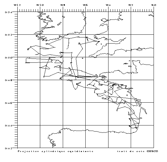
-Analysis of vessel movements to model local weather conditions and compare them with ARGOS data (CIMMEO project).
-Archiving of EK 500 echosounder data for bioacoustic studies.
|
| Location map |
|
| Positionning system |
Geodetic system : WORLD GEODETIC SYSTEM 1984 = WGS84
Positioning system : GPS différentiel
|
|


