| Sea/Ocean |
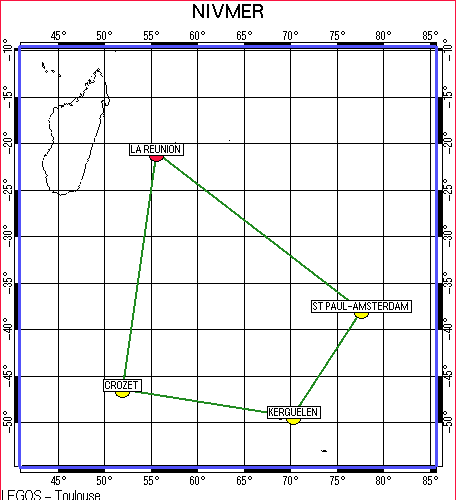
Indian Ocean (TAAF (Terres Australes et Antactique Francaises)) |
| Ports |
Port of departure : Le Port (Réunion)
Port of return : Fremantle (Australia)
|
| Project |
NIVMER - SEA LEVEL |
| Scientific Authority |
ECOLE NATIONALE DES SCIENCES GEOGRAPHIQUES (ENSG) - IGN 6 & 8 Avenue Blaise Pascal Cite Descartes Champs sur Marne Cedex 2 77455 MARNE-LA-VALLEE +33(0)1 64 15 30 01 https://www.ensg.eu/ |
| Participating bodie(s) |
LEGOS - DT/INSU - IPEV - CNRS/INSU - IFREMER - Institut Géographique National. |
| Discipline(s) |
| Code |
Label |
Quantity |
PI |
| D09 |
Sea level (incl. bottom p. IES) Marégraphes côtiers de Kerguelen et Saint-Paul (mesure horaire) |
3 deployments |
LE PROVOST Christian |
|
| Summary of measurements |
- -Deployment of AMS03 tide gauge on the bottom of the sea of Amsterdam (AMS03)after having discovered that AMS02 was missing.
-Attempt to recover the CR0023 (Crozet) tide gauge interrupted due to sea conditions.
-Maintenance of coastal tide gauge at Port aux Français (Kerguelen).
-Maintenance of coastal tide gauge at Saint-Paul.
-Surveying and making contact to install a permanent GPS unit at Crozet.
GPS session on the existing geodesic pillar.
-Surveying and making contact to install a second permanent GPS unit at Port aux Français (Kerguelen). GPS session on the existing geodesic pillar.
-Surveying and making contact to install a permanent or semi-permanent GPS unit on Saint-Paul.
|
| Location map |
|


