| Sea/Ocean |
Bay of Biscay |
| Ports |
Port of departure : Brest (France)
Port of return : Brest (France)
|
| Project |
INFORMATION SYSTEMS, ECONOMY, DIAGNOSIS OF RESOURCES |
| Scientific Authority |
ÉCOLOGIE ET MODÈLES POUR L'HALIEUTIQUE Centre Ifremer de Nantes Rue de l'Ile d'Yeu 44311 Nantes Cedex 3 +33 (0)2 40 37 41 67 |
| Participating bodie(s) |
IFREMER, CNRS, AZTI |
| Discipline(s) |
- CHEMICAL OCEANOGRAPHY
- PHYSICAL OCEANOGRAPHY
- BIOLOGICAL OCEANOGRAPHY
- ENVIRONMENT
| Code |
Label |
Quantity |
PI |
| B02 |
Phytoplankton pigments (eg chloroph Chlorophyll by size class |
35 stations |
DUPUY Christine |
| B07 |
Pelagic bacteria/micro-organisms Bacteria and microplankton |
35 |
DUPUY Christine |
| B08 |
Phytoplankton |
35 |
DUPUY Christine |
| B09 |
Zooplankton Biomass and specific composition |
56 |
DUPUY Christine |
| B13 |
Eggs & larvae Continuous Underway Fish Egg Sampler (CUFES) |
750 |
PETITGAS Pierre |
| B14 |
Pelagic fish |
64 specimens |
MASSE Jacques |
| B25 |
Birds Observations |
60 observations |
BRETAGNOLLE Vincent |
| B26 |
Mammals & reptiles Marine mammal observations |
560 observations |
RIDOUX Vincent |
| B28 |
Acoustic reflection on marine organ |
3420 |
MASSE Jacques |
| B71 |
Particulate organic matter (inc POC |
35 |
DUPUY Christine |
| B72 |
Biochemical meas. (eg,lipids,amino Enzymatic activity - zooplankton production |
56 |
BERGERON Jean-Pierre |
| G73 |
Single-beam echosounding |
- |
MASSE Jacques |
| H09 |
Water bottle stations |
35 stations |
DUPUY Christine |
| H10 |
CTD stations SBE911+SBE19+Fluorescence |
75 stations |
PLANQUE Benjamin |
| H17 |
Optics (eg underwater light levels) Continuous subsurface fluorescence |
- |
PLANQUE Benjamin |
| H71 |
Surface measurements underway (T,S) Thermosalinometer |
- |
PLANQUE Benjamin |
| M06 |
Routine standard measurements Wind and weather stations |
- |
MASSE Jacques |
|
| Summary of measurements |
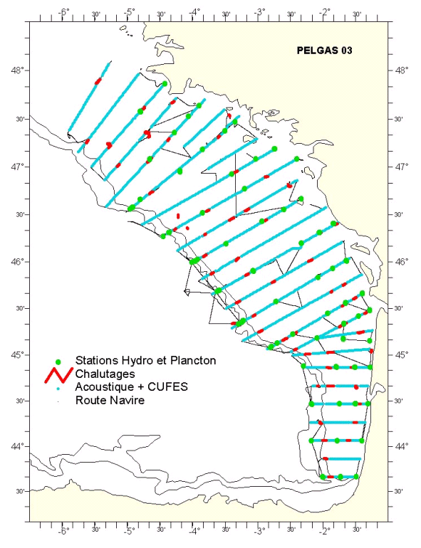
- -Acoustic prospecting (10 knots)
-Pelagic or bottom trawling to identify fish.
-Hydrological and plankton stations.
-CUFES system sampling.
-Counting marine mammals and birds observed along the legs being explored.
|
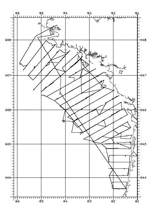
| Location map |
|
| Positionning system |
Geodetic system : WORLD GEODETIC SYSTEM 1984 = WGS84
Positioning system : GPS différentiel
|
|


