FOCUS-G3
| Type | Oceanographic cruise |
|---|---|
| Set | This cruise is part of the set FOCUS |
| Ship | Téthys II |
| Ship owner | CNRS until 2019 - IFREMER since 2020 |
| Dates | 21/08/2023 - 26/08/2023 |
| Chief scientist(s) | ROYER Jean-Yves  |
GEO-OCEAN - UMR 6538 IFREMER - Technopôle Brest-Iroise IUEM - Rue Dumont d'Urville 29280 Plouzané |
|
| DOI | 10.17600/18002515 |
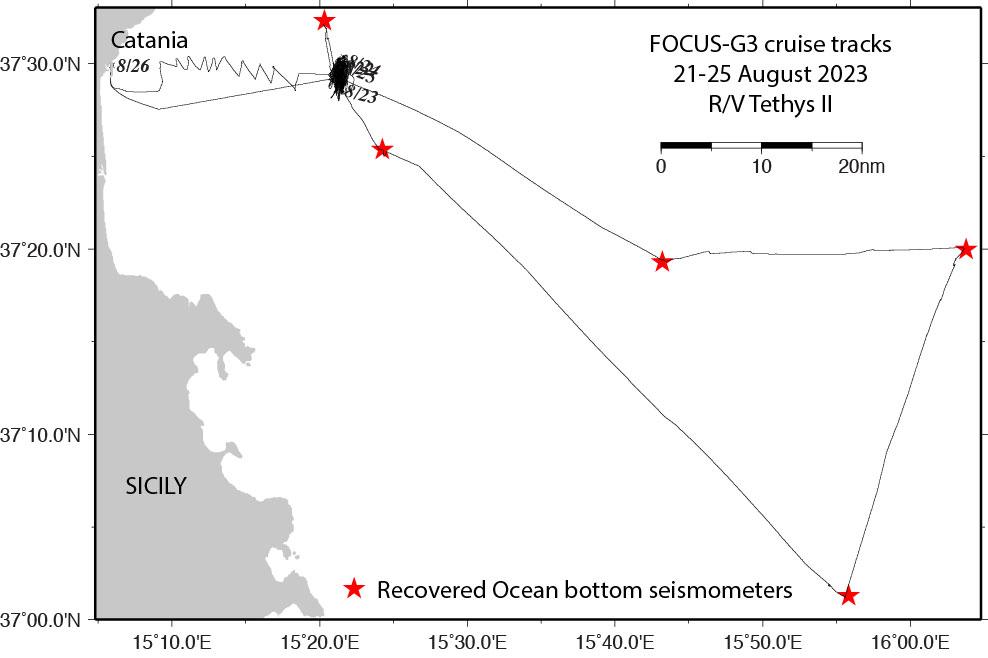
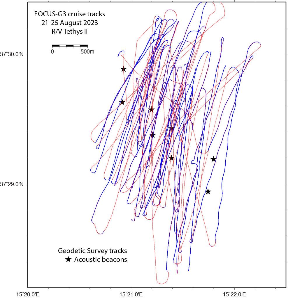
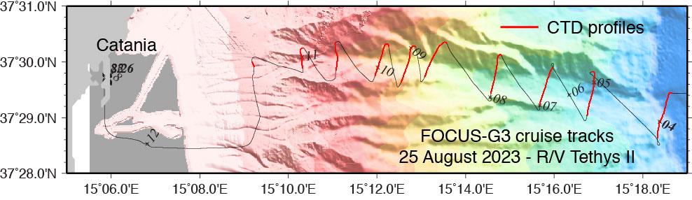
| Objective | The FOCUS-G3 oceanographic campaign is part of the ERC FOCUS project (2020-2025) to monitor the North-Alfeo fault, off Mount Etna in the Ionian Sea. The aim of this ERC project is to measure the fault's displacements using laser reflectometry on an optical fiber cabled to shore. To calibrate these measurements, acoustic beacons were also deployed on either side of the fault, close to the optical fiber, to measure their relative displacement (acoustic telemetry). The fiber and beacons were deployed in October 2020. Following their premature shutdown, all the beacons had to be recovered in 2022 and redeployed in early 2023. This campaign follows the NO L'Atalante's FOCUS-X3 mission in February 2023, during which a network of 13 acoustic beacons (LGO network) was redeployed on either side of the fault and the fiber. A second network of acoustic beacons has been installed by the Geomar Institute since December 2021 on another segment of the fault, on Etna's eastern flank. In addition to this displacement monitoring, a network of seafloor seismometers (OBS) monitors the fault's seismic activity. The objectives of the cruise were:
The main purpose of the FOCUS-G3 mission was to ensure that the acoustic beacons were still operating nominally, and to complete the time series of relative and absolute positioning. These acquisitions will be repeated in 2024. In addition to the geodynamic and methodological implications of the project (fiber vs. acoustic), the aim is to demonstrate that measuring absolute seafloor displacements in the order of cm/year is possible. The objectives achieved were:
Figures:
|