CONFLUENCE-CLIVAR
| Type | Oceanographic cruise |
|---|---|
| Set | This cruise is part of the set CONFLUENCE |
| Ship | Puerto Deseado |
| Dates | 02/12/2001 - 19/11/2003 |
| Chief scientist(s) | PROVOST Christine |
LABORATOIRE D'OCÉANOGRAPHIE ET DU CLIMAT : EXPÉRIMENTATIONS ET APPROCHES NUMÉRIQUES - UMR 7159 Institut Pierre Simon Laplace Boîte 100 4 place Jussieu 75005 Paris +33 (1) 44 27 32 48 |
|
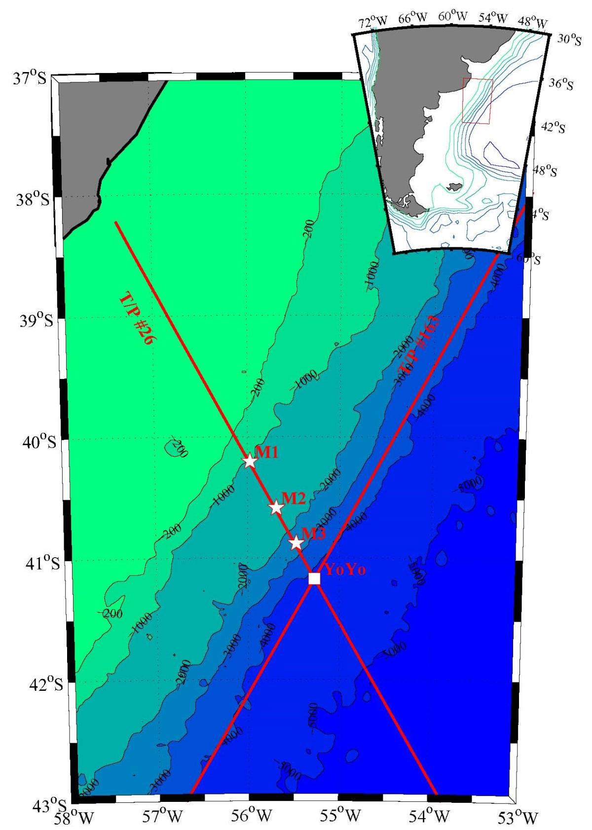
| Objective | Monitoring phase of the CONFLUENCE programme: A network of current meter moorings was placed during the Confluence experiment of the WOCE programme through the Falklands Current under a track of the altimetry satellite TOPEX_POSEIDON. Thus we were able to understand the vertical structure of the current and show that the satellite altimeter can monitor the transport of the current. Seasonal and intra-seasonal variations in the transport of the current were described and the mechanisms responsible for these variations were highlighted. An accurate estimation of the transport by altimetry requires the knowledge of an average velocity field across a current section. In the approach used by Vivier and Provost (Volume transport of the Malvinas Current: Can the flow be monitored by TOPEX/POSEIDON? J.G.R., 104, 21105-21122) the mean field used comes from an objective analysis of the measurements. However, in order to make a reasonable estimate of the interannual component of current variations, it seems necessary to redetermine the mean field strength over a period of at least one year in order to compare and then combine it with our previous estimate. It is also necessary to determine whether the relatively satisfactory agreement between the transport determined by altimetry and the transport obtained by current measurement was factual or persistent over time, and to what extent. We set up in December 2001 from the Argentinian ship Puerto Deseado and at the time of the launch of the JASON satellite a minimalist instrumentation to achieve these objectives (CONFLUENCE-CLIVAR project). Experience from past measurements leads us to believe that these objectives can be achieved with relatively modest means: three judiciously located moorings consisting of two current meters in the subsurface layer appear to be sufficient.
This cruise was carried out in 3 legs :
|