GAZCOGNE3
| Type | Oceanographic cruise |
|---|---|
| Set | This cruise is part of the set GAZCOGNE |
| Ship | Thalassa |
| Ship owner | Ifremer |
| Dates | 27/08/2018 - 03/09/2018 |
| Chief scientist(s) | DUPRE Stéphanie  , MARSSET Bruno , MARSSET Bruno |
GEO-OCEAN - UMR 6538 IFREMER - Technopôle Brest-Iroise IUEM - Rue Dumont d'Urville 29280 Plouzané |
|
| DOI | 10.17600/18000652 |
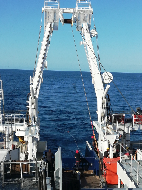
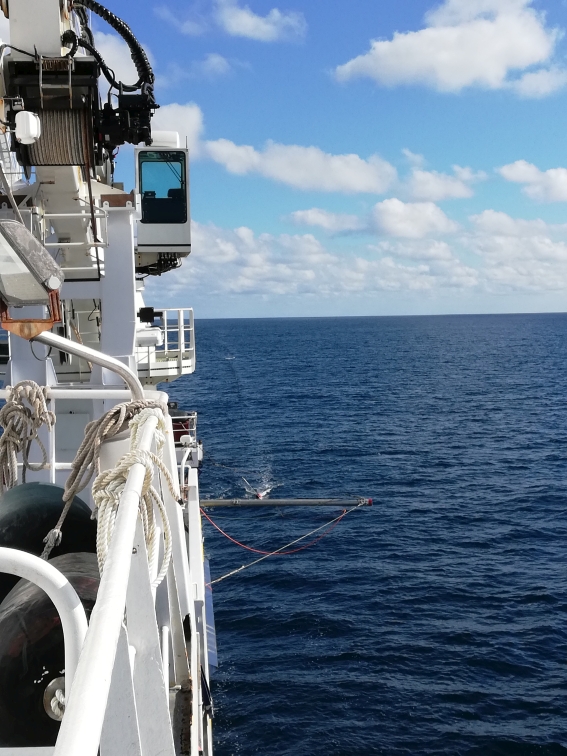
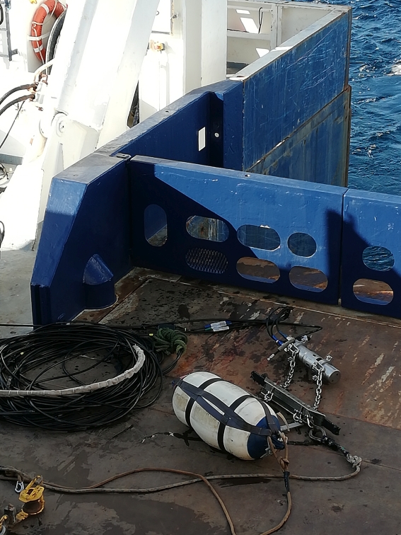
| Objective | The primary objective of the marine expedition GAZCOGNE3 is to constrain the in-depth geometry of the microbial fluid system of the Aquitaine Shelf (Dupré et al. 2014; Pierre et al. 2017; Ruffine et al. 2017). To achieve this, multichannel seismic equipment designed for submarine shelf studies were deployed. Indeed, available data from previous marine expeditions (ITSAS I, BOBGEO2, GAZCOGNE1) in the area are not able to properly image the uppermost sediments as well as the fluid system in its in entirety. This is partly due to the presence of indurated rocks (methane-derived authigenic carbonates) at the seafloor and in sub-surface within the sedimentary pile. These carbonates are causing strong amplitude anomalies in seismics and strongly prevent the signal from penetrating underneath. The new multichannel seismic streamer from the Marine Geosciences Unit (Ifremer) dedicated to shelf studies (48 traces with an inter trace of 3.125 m) is particularly well suited to explore the Aquitaine Shelf fluid system. During the marine expedition GAZCOGNE3 (2018) onboard the R/V Thalassa, this multichannel streamer was coupled with an air gun (mini-GI 13 inches3, Genavir). This type of source is used for the stability of its signature and its energy (required because of the presence of hard substrates). A second seismic source (Sparker) was however deployed for its high-resolution quality, and this, along a few selected profiles. In total 320 nm long seismic lines were acquired during GAZCOGNE3 thanks to very good weather conditions for the end of August. Newly acquired seismic data once processed onland are going to provide much better images the roof of the fluid system, and possibly of the entire fluid system depending on its vertical extent. Gas and carbonate distributions could be therefore better defined thanks to high-resolution seismic imaging and sediment characterisation by velocity analyses. In addition to the seismic dataset, complementary data were acquired with the hull-mounted echosounders of the R/V Thalassa : ADCP (38 kHz) and wide-band single beam echosounder EK80 (18, 38, 70, 120, 200 and 333 kHz) for water column imagery, and a sub-bottom profiler echosounder (1.5-6.5 kHz) for imagery of the surface sedimentary layers.
|