Context
Coastal environments are strongly influenced by terrigenous supplies from rivers. Determining the quantity of nutrient, pollutant, and contaminant supplies is essential for marine resource protection. Interfaces between fresh and salt waters, as for instance estuaries, are dynamic areas experiencing strong gradients of temperature, salinity, turbidity, and biogeochemical processes, with an important filtration role. Such areas can impact dissolved and particulate fluxes from rivers to seas, as for instance metallic contaminants in the Gironde Estuary (Dabrin, 2009; Lanceleur, 2010). Evaluating net fluxes between rivers and seas is therefore a major issue to quantify the influence of continental supplies on marine systems (Eyrolle et al., 2011).
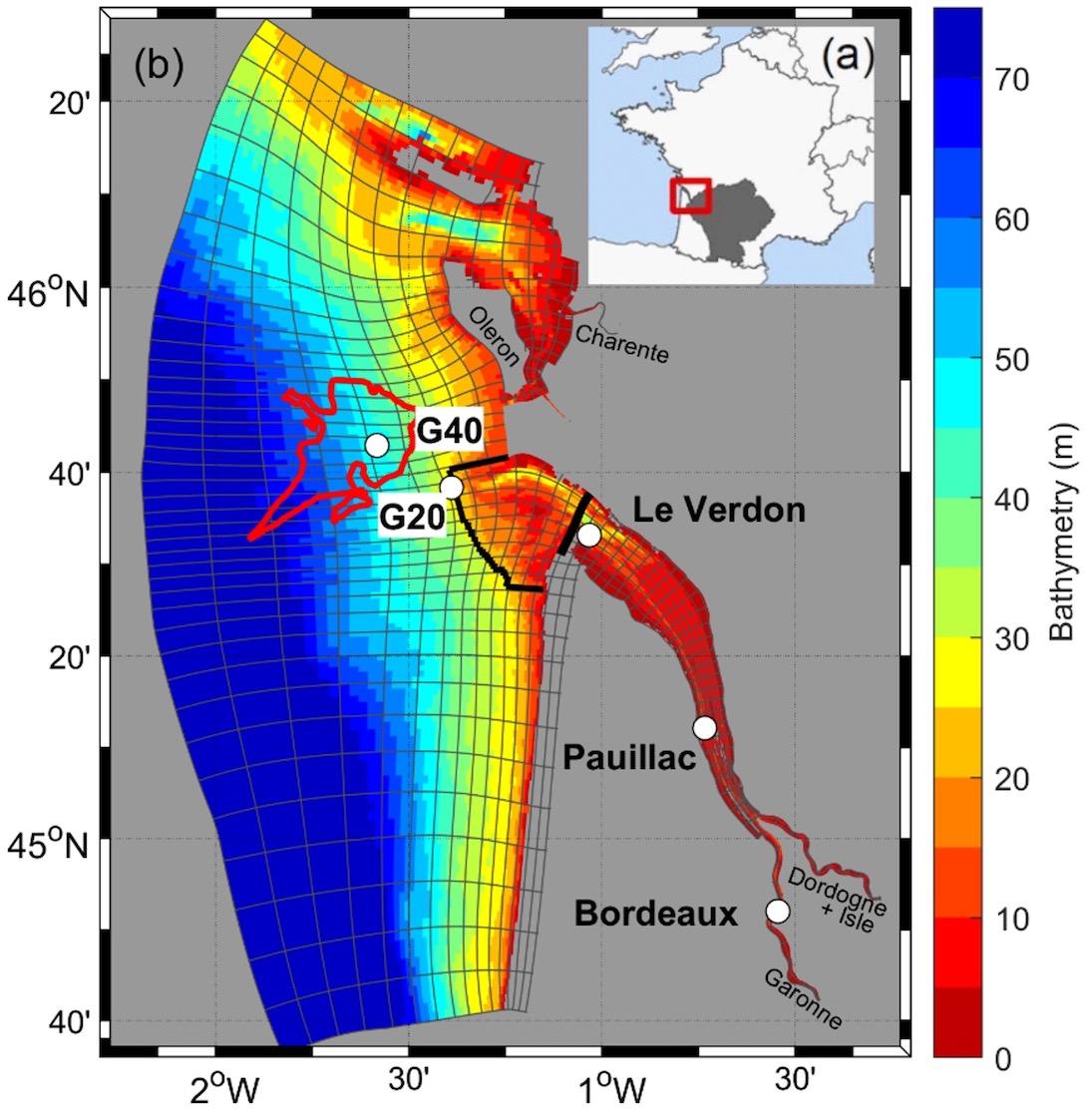
Two main questions are related to river-sea particulate transfers. On the first hand, intra-estuary processes are influenced by the presence of turbidity maximum and intertidal flats. And on the other hand, particulate matters exported from the estuary are likely deposited in less energetic areas along the continental shelf, and potentially trapped on subtidal mudflats or resuspended and advected to coastal areas (e.g., Sottolichio et al., 2000; Le Hir et al., 2001). Concerning such dynamics, The Gironde Estuary is specifically relevant, having one of the most developed estuarine turbidity maximum in Europe (with suspended sediment concentrations reaching few g/l at the surface), and two subtidal mudflats on the Bay of Biscay continental shelf close to the estuary mouth (Figure 1). Such mudflats (e.g., the West Gironde Mud Patch) represent temporary or permanent receptacles for fines particles coming from the Gironde Estuary (Lesueur et al., 2002).
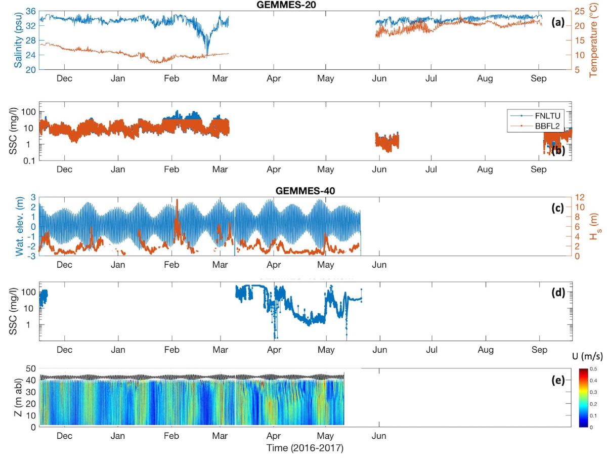
In this context, the METEOR campaigns aimed at carrying out multi-parameter measurements between the Gironde Estuary mouth and the West Gironde Mud Patch:
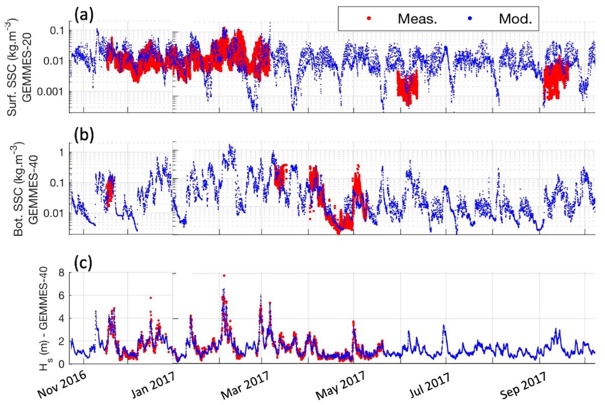
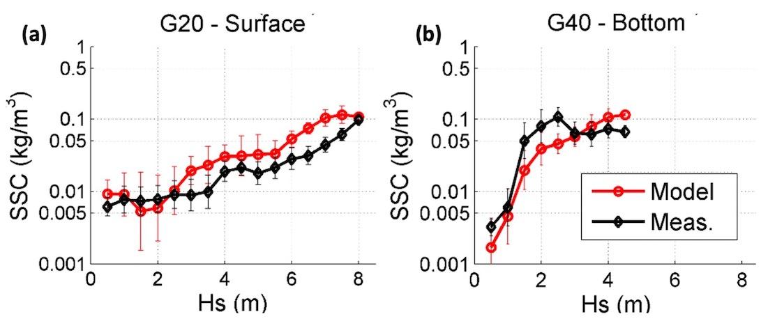
- to calibrate and validate simulated sediment fluxes between the estuary and the continental shelf (project AMORAD, see below).;
- to validate satellite products based on water color images (e.g., suspended sediment concentration, Chl-a) dedicated to the Gironde Estuary and its turbid plume (project HIGHROC, see below).
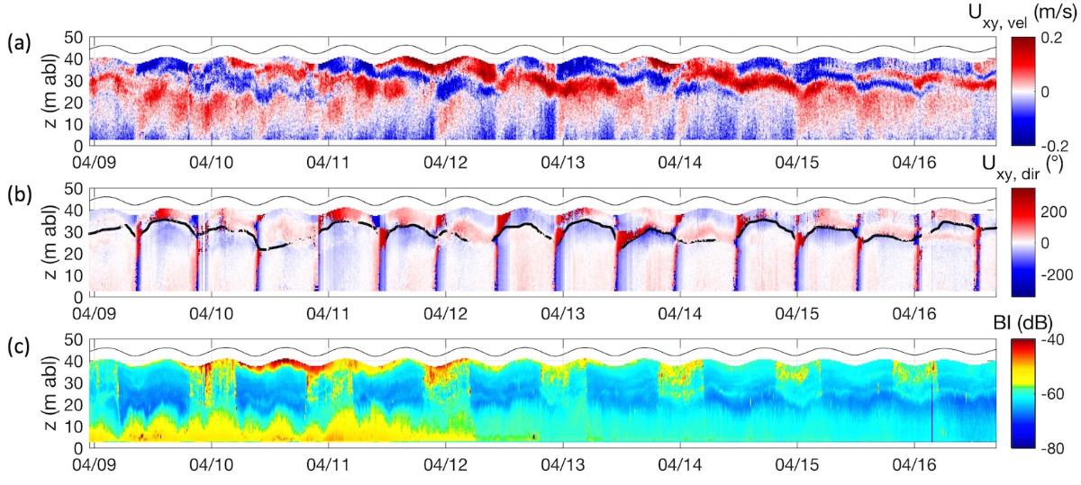
In addition, these campaigns aimed at measuring the seasonal sediment dynamics (continuous measurements + campaigns every trimester).

Figure 1. Map of surficial sedimet distribution on the Bay of Biscay continental shelf and at the mouth of the Gironde Estuary (from Castaing, 1981 and Doxaran, 2002).
Associated programmes
The ANR AMORAD project (2013-2022) aimed at ¿Improving radionuclides dispersion and impact assessment modelling in the environment¿ within marine, continental and atmospheric compartments. In this framework, the objective of the ¿Sediment Task¿ in the ¿Marine Axe¿ was to improve the understanding and modelling of particulate matter fluxes. More specifically, a doctoral project was dedicated to the modelling of sediment transfers between the Gironde Estuary and the adjacent continental shelf in the Bay of Biscay (Diaz, 2019), in order: (i) to evaluate the influence of hydrometeorological events on particulate fluxes, and (ii) to determine the dispersion and accumulation areas of estuarine particles on the continental shelf.
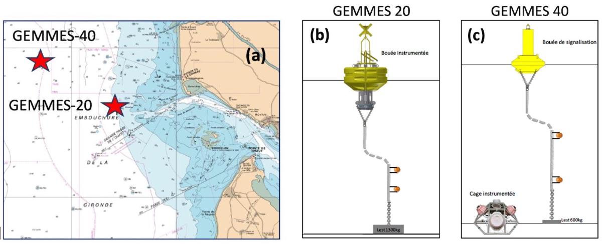
To answer these questions, it was necessary to assess the turbidity at the mouth of the Gironde Estuary, which has not been done before. Such a lack of data has motivated the METEOR campaigns and the deployment of new instrumented stations.
The FP7 HIGHROC European project (HIGH spatial and temporal Resolution Ocean Colour products and services) develops products and services for European coasts based on water colour satellite images. Improving spatial and temporal resolutions opens new application fields for teledetections (e.g., Oyster farming, dredging), as well as providing information for the European Marine Strategy Framework Directive. In this context, the METEOR campaigns enabled to carry out match-ups between in-situ measurements and satellite images to validate satellite products developed for the Gironde Estuary and its turbid plume (e.g., turbidity, suspended sediment concentration, Chl-a, optical depth, reflectance).
References
Castaing P. 1981. Le transfert à l'océan des suspensions estuariennes : cas de la Gironde. Thèse de l'U. Bordeaux 1, 530.
Dabrin A., 2009. Mécanismes de transfert des éléments traces métalliques (ETM) et réactivité estuarienne ¿ Cas des systèmes Gironde, Charente, Seudre et Baie de Marennes Oléron. Thèse de l'Université Bordeaux I.
Doxaran D., 2002. Télédétection et modélisation numérique des flux sédimentaires dans l'estuaire de la Gironde. Thèse de l'U. Bordeaux 1, 278p. + annexes.
Eyrolle F., et al., 2011. EXTREMA contrat ANR-06-VULN-005, Episodes météo climatiques extrêmes et redistribution des masses sédimentaires et des polluants associés au sein d'un système côtier. Colloque de restitution finale, Compilation des actes du colloque, Rapport DEI/SESURE 2011-24.
Lanceleur L., 2010. L'argent, sources, transfert et bioaccumulation ¿ Cas du système fluvio-estuarien girondin. Thèse de l'Université Bordeaux I.
Le Hir, P., A. Ficht, R. Silva Jacinto, P. Lesueur, J.-P. Dupont, R. Lafite, I. Brennon, B. Thouvenin, P. Cugier, 2001. Fine Sediment Transport and Accumulations at the Mouth of the Seine Estuary (France). Estuaries, 24(6B), 950-963.
Sottolichio A., P. Le Hir, P. Castaing, 2000. Modeling mechanisms for the turbidity maximum stability in the Gironde estuary, France, In: W.H. McAnally, A.J. Mehta (Eds.), Coastal and Estuarine Fine Sediment Processes, Elsevier, Amst, 373-386.


