CASEIS
| Type | Oceanographic cruise |
|---|---|
| Ship | Pourquoi pas ? |
| Ship owner | Ifremer |
| Dates | 28/05/2016 - 05/07/2016 |
| Chief scientist(s) | FEUILLET Nathalie |
INSTITUT DE PHYSIQUE DU GLOBE DE PARIS - UMR 7154, UMS 3454 1 rue Jussieu 75005 Paris +33 (0)1 83 95 74 00 |
|
| DOI | 10.17600/16001800 |
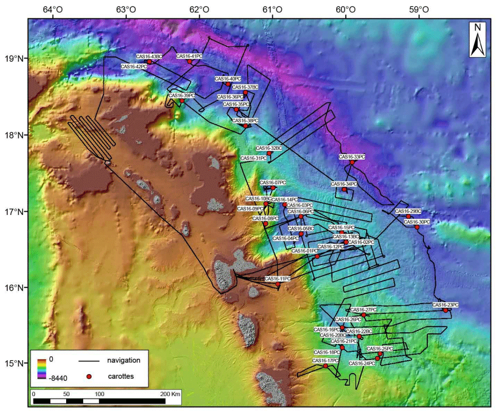
| Objective | The Lesser Antilles subduction area is poorly known and the historical earthquake catalog is too short (500 years) to estimate the recurrence time of large earthquakes in this area. For example, an earthquake as wide as the 2011 Tohoku megathrust earthquake in Japan may recur every 1000 years (K. Minoura et al., 2001). Existing models to predict earthquake recurrence over the long term have not been successful, thus paleoseismology is the only way to address long term earthquake recurrence. The largest earthquake reported in the Lesser Antilles arc has occurred on Feb. 8, 1843. It was felt with a maximum intensity of IX to X and has destroyed the town of Pointe-à-Pitre, killing thousands of people. It may have reached a magnitude larger than 8 and maybe 8.5 (Feuillet et al, 2011.; Hough et al., 2013). The objective of the CASEIS marine cruise is to perform a submarine paleoseismological study based on turbidite records to decipher the earthquake history along the Lesser Antilles subduction area. Unlike other phenomena (eruption, flood, local shallower and smaller earthquakes, volcano flanks or local reef platform destabilization), very large subduction earthquakes offshore can trigger turbidity currents over a wide area (at least as wide than the rupture zone). It is possible, to find coseismic turbidites in most basins and channels systems of the upper plate, above the rupture area. We aim to establish a broad catalog of earthquakes over the Holocene and late Quaternary in the northern part of the Lesser Antilles by performing cores in basins, at the mouth of the main canyons and along major tributaries. We collected 510 m of sediment cores over a distance of 500 km between Martinique and the Anegada Passage between may 28 and July 5, 2016 on board of the french research vessel Pourquoi Pas?. Multibeam bathymetric data, imagery and 3.5 kHz seismic profiles allowed us to identify,map and characterize the channels and basins before coring. |


