ATACAMES-EQUA
| Type | Oceanographic cruise |
|---|---|
| Ship | L'Atalante |
| Ship owner | Ifremer |
| Dates | 15/01/2012 - 19/02/2012 |
| Chief scientist(s) | MICHAUD François , PROUST Jean-Noël |
LABORATOIRE GEOAZUR - UMR 7329 / UR082 250 rue Albert Einstein CS 10269 Campus Azur 06905 Sophia-Antipolis +33 (0)4 92 94 26 02 |
|
| DOI | 10.17600/12010010 |
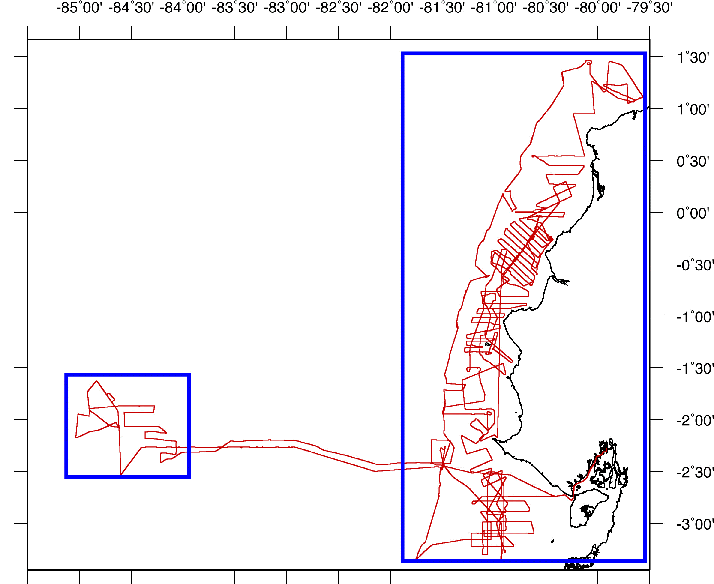
| Objective | There were three objectives to the ATACAMES cruise: 1) To analyze the Pleistocene tectonic-climatic records using seismic and sequential stratigraphy on the continental shelf and upper slope basins (depths between 100 and 1,000m). Using geophysical techniques (high resolution seismic reflection profiles + core sampling), the aim was to identify the geometry, seismic facies and distribution of sedimentary bodies to benchmark the stratigraphic successions of transgression and regression during the Pleistocene. This succession of sequences will be calibrated using the coring performed, comparison of global climatic-eustatic curves and correlations with emerged sequences. This chronostratigraphic benchmark will be the basis for determining the chronology of tectonic deformation of sedimentary bodies and reconstructing the morphological-structural evolution of the margin in the Pleistocene. 2) To analyze paleo-seismicity based on study of cores taken in the subduction trench. Climate-related events and high magnitude earthquakes cause slope instability which generates turbiditic deposits and debris flows. These catastrophic events are recorded in the stratigraphy of slope basins and of the marginal trench in subduction. These sedimentary recordings provide a unique opportunity to expand the local seismic catalogues for the prehistoric to Holocene period, thus supplying a broader basis for probabilistic seismic hazard analysis. This will make it possible to document the return period, spatial distribution and magnitude of subduction earthquakes, as well as their potential impact on marine and coastal environments. 3) Adding these elements will enable us to date and understand how the fields of pockmarks in the carbonate sediment on the flanks of the Carnegie Ridge were formed. |

